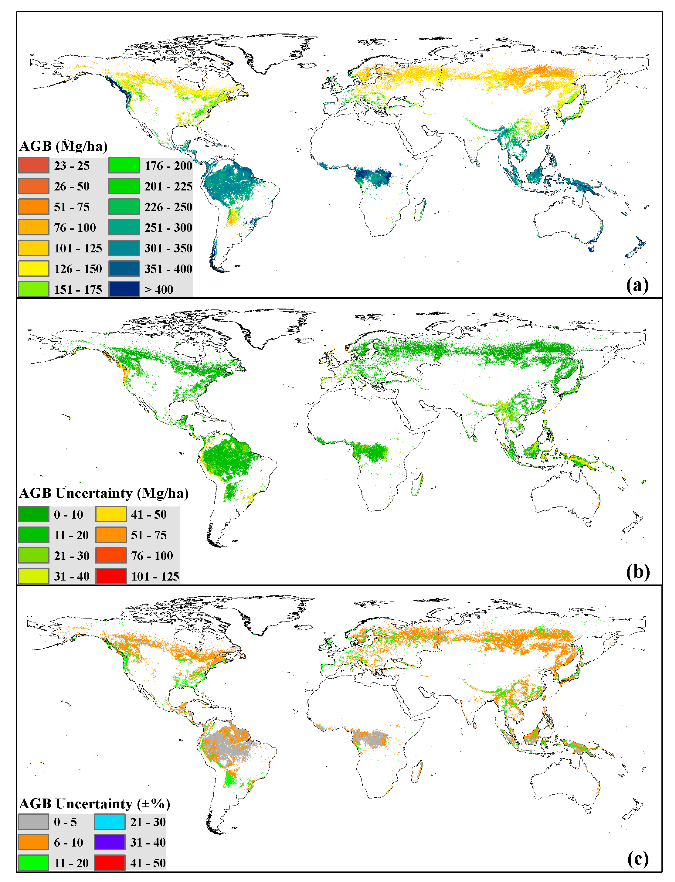
Global forest ecosystems form a large carbon pool, and are a critical component of the global carbon cycle. Accurate estimations of global forest aboveground biomass (AGB) will improve understanding of global carbon dynamics and help quantify anthropogenic carbon emissions. Light detection and ranging (LiDAR) techniques have been proven to accurately capture both horizontal and vertical forest structures and increase the accuracy of forest AGB estimation. In this study, we mapped the global forest AGB density at a 1-km resolution through the integration of ground inventory data, optical imagery, Geoscience Laser Altimeter System/Ice, Cloud, and Land Elevation Satellite data, climate surfaces, and topographic data. Over 4000 ground inventory records were collected from published literatures to train the forest AGB estimation model and validate the resulting global forest AGB product. Our globally continuous or wall-to-wall forest AGB map showed that the global forest AGB density was 210.09 Mg/ha on average, with a standard deviation of 109.31 Mg/ha. The wall-to-wall forest AGB map was evaluated at plot level and ecological zone level using independent plot measurements. The results showed that the forest AGB estimates were reliable. The adjusted coefficient of determination (R2) and root-mean-square error (RMSE) between our predicted results and the validation plots were 0.56 and 87.53 Mg/ha, and those at the ecological zone level were 0.56 and 101.21 Mg/ha, respectively. A comprehensive comparison was also conducted between our forest AGB map and other published regional AGB products. Overall, our forest AGB map showed good agreement with these regional AGB products, but some of the regional AGB products tended to underestimate forest AGB density.
Reference
Hu, T., Su, Y., Xue, B., Liu, J., Zhao, X., Fang, J., Guo, Q. * 2016. Mapping global forest aboveground biomass with spaceborne LiDAR, optical imagery, and forest inventory data. Remote Sensing. 8(7): 565.
