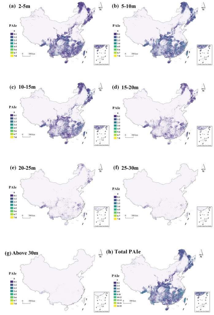
Effective plant area index (PAIe) is a fundamental metric for characterizing forest vertical structural complexity and ecosystem stability, serving as a critical input for ecological modeling, biodiversity assessment, and forest management. At the canopy stratum level, stratified PAIe reveals light interception and microclimatic heterogeneity, while cumulative total PAIe reflects overall plant material density and canopy biomass accumulation. However, spatially explicit and wall-to-wall stratified PAIe products currently remain unavailable at national or global scales. We developed a multi-task deep learning framework (PAIe-MoE) based on a mixture-of-experts mechanism that integrates extensive UAV LiDAR and multi-source remote sensing data for generating stratified PAIe products across China. We compiled over 130,000 UAV laser scanning (ULS) plots from 608 flights covering 431.74km2 across China and derived high-accuracy stratified PAIe profiles using an optimized physical retrieval configuration. The ULS-derived PAIe profiles were stratified at 5 m vertical intervals within 30 m plots and served as training data to generate wall-to-wall stratified PAIe maps across China at 30 m spatial resolution and 5 m vertical resolution. To our best knowledge, this is the first wall-to-wall forest stratified PAIe map across China, providing the first nationwide 3D characterization of forest vertical structure. The results showed that the vertical distribution of PAIe concentrated in the mid-canopy (5–10 m layer representing the center of mass with a mean PAIe of 1.22 and 31.26% contribution to total PAIe), while total PAIe prediction achieved an R2 of 0.69 and RMSE of 1.48 on an independent test set of 6,575 ULS plots. The proposed framework and maps provide a new 3D dimension for monitoring forest structural dynamics, assessing ecosystem stability, and supporting sustainable forest management toward carbon-neutrality goals.
Reference:
Qi Zhiyong, Bai Zitong, Yang Haitao, Wang Yao, Cheng Kai, Yang Zekun, Chen Ang, Xiang Tianyu, Ren Yu, Zhang Yixuan, Chen Yuling, Wang Qingpeng, Xu Guangcai, Fang Hongliang, Guo Qinghua. 2026. Unveiling forest vertical structure across China through stratified effective plant area index using extensive UAV LIDAR and multi-source remote sensing data. Remote Sensing of Environment. 343(2026): 115492.