On February 28, 2025, the research findings from the Digital Ecosystem Group were featured in BBC Wildlife (Discover Wildlife), with the full report available at https://www.discoverwildlife.com/plant-facts/trees/how-many-trees-are-there-in-china. This pioneering study, published in Science Bulletin, delivers the most detailed assessment of tree abundance and spatial distribution across China to date, achieved by integrating over 400 terabytes of data from 76,000 forest plots with environmental factors and advanced machine-learning algorithms.

GeoAI Research
GeoAI research Our team is dedicated to frontier research in Geospatial Intelligence (Geo-AI), building a comprehensive technical framework centered on spatiotemporal foundation models. By integrating multi-source heterogeneous data—including point clouds, imagery, and text—we have overcome critical bottlenecks in cross-modal alignment and spatiotemporal big data mining. We focus on developing AI-driven perception algorithms and structural modeling […]
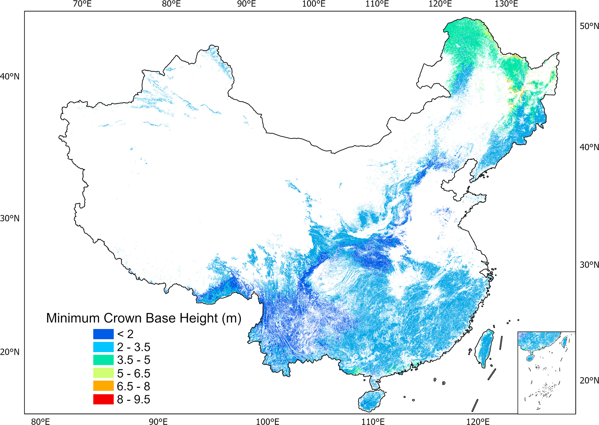
China forest crown base height
Crown base height (CBH) is essential for characterizing forest vertical structure over time for sustainable forest management and serves as a key input in fire model and growth model. At plot level, the average CBH (CBHa) is mainly used to assess tree growth and construct biomass models while the minimum CBH (CBHmin) can indicate the […]

Spatial Intelligence & Geo-Foundation Models
Spatial Intelligence & Geo-Foundation Models Our research group focuses on the core domains of Spatial Intelligent Perception and Autonomous Navigation, driven by the frontier of Geospatial Intelligence (GeoAI). We integrate cutting-edge technologies including LiDAR SLAM, photogrammetry, and multi-source information fusion, with a strategic emphasis on Geospatial Foundation Models. To meet the operational requirements of mobile […]
Global vegetation products-draft
Global Vegetation Products (1) Global forest AGB map in 2004 Global forest ecosystems form a large carbon pool, and are a critical component of the global carbon cycle. Accurate estimations of global forest aboveground biomass (AGB) will improve understanding of global carbon dynamics and help quantify anthropogenic carbon emissions. In this study, we mapped the […]
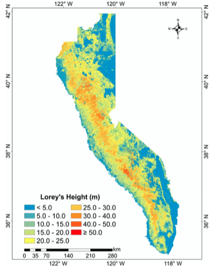
Regionl vegetation products
Regional Vegetation Products Forests tree height across the Sierra Nevada Forests of the Sierra Nevada (SN) mountain range are valuable natural heritages for the region and the country, and tree height is an important forest structure parameter for understanding the SN forest ecosystem. There is still a need in the accurate estimation of wall-to-wall SN […]

Sample data for the book “LiDAR Data Processing Methods -A LiDAR360 Software Tutorial (in Chinese)”
This book systematically explains the principles of LiDAR technology and, using the LiDAR360 software platform as an example, provides detailed instructions on LiDAR point cloud data processing and its applications in various fields. It is divided into three parts and comprises fifteen chapters. The first part, Chapter 1, provides an overview of LiDAR technology, its […]
China Vegetation Products version 1.0 (CVP v1.0)
Vegetation is a crucial component of ecosystems, playing a vital role in maintaining biodiversity, regulating climate, and protecting soil and water resources. As one of the countries with the most diverse vegetation types in the world, China’s vegetation resources carry significant ecological functions and environmental benefits. In recent years, due to both natural and human […]
Environmental Change and Terrestrial Ecosystem Response
Environmental Change and Terrestrial Ecosystem Response Changes of forest quality are composed by the changes in forest structure and species composition, which are usually caused by tree growth, anthropogenic activities (e.g., forest treatment, logging), and environmental disturbances (e.g., drought, flood, and wildfire). To quantitatively assess forest structure changes from multitemporal lidar data, we proposed an […]
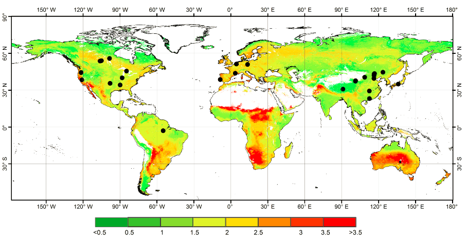
Global forest woody residence time in 2004
Global forest woody residence time by random forest method Woody residence time is an important parameter that expresses the balance between mature forest recruitment/growth and mortality. Using field data collected from the literature, our group explored the global forest τw and investigated its influence on model simulations of aboveground biomass (AGB) at a global scale. […]