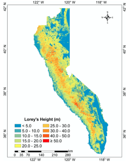
Forests of the Sierra Nevada (SN) mountain range are valuable natural heritages for the region and the country, and tree height is an important forest structure parameter for understanding the SN forest ecosystem. There is still a need in the accurate estimation of wall-to-wall SN tree height distribution at fine spatial resolution. In this study, we presented a method to map wall-to-wall forest tree height (defined as Lorey’s height) across the SN at 70-m resolution by fusing multi-source datasets, including over 1600 in situ tree height measurements and over 1600 km 2 airborne light detection and ranging (LiDAR) data. Accurate tree height estimates within these airborne LiDAR boundaries were first computed based on in situ measurements, and then these airborne LiDAR-derived tree heights were used as reference data to estimate tree heights at Geoscience Laser Altimeter System (GLAS) footprints. Finally, the random forest algorithm was used to model the SN tree height from these GLAS tree heights, optical imagery, topographic data, and climate data. The results show that our fine-resolution SN tree height product has a good correspondence with field measurements. The coefficient of determination between them is 0.60, and the root-mean-squared error is 5.45 m.
Reference:
Su, Y., Ma, Q., and Guo, Q. (2017). Fine-resolution forest tree height estimation across the Sierra Nevada through the integration of spaceborne LiDAR, airborne LiDAR, and optical imagery. International Journal of Digital Earth 10, 307–323.
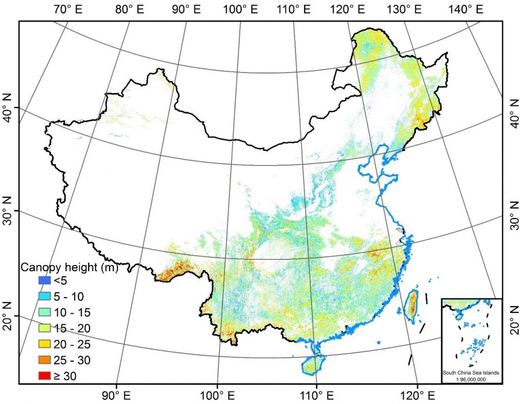 Forest tree height map of China