Mapping the new generation Vegetation Map of China-1
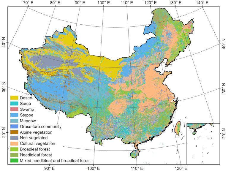
Vegetation maps provide crucial information for ecological studies, biodiversity conservation, vegetation management and restoration, and national strategic decision making. The current vegetation map of China was produced by a team of more than 250 scientists over the course of two decades starting in the 1980s, who spent a huge amount of efforts to manually delineate vegetation formation/sub-formation boundaries and recognize vegetation formation/sub-formation types in the field. This work fulfilled the needs of a national vegetation map of China at a scale of 1:1000000, and has been used as a fundamental input for policy making and ecological studies since its publication. However, China has experienced rapid development during the last three decades, and its vegetation distribution has changed drastically due to climate change and anthropogenic activities (e.g., urban development, afforestation and management of desertification). The vegetation map of China urgently needs to be updated to improve the understanding and management of China’s terrestrial ecosystems. Our undergoing project supported by the Strategic Priority Research Program of the Chinese Academy of Sciences aims to fulfill this goal by a “crowdsourcing -deep learning-expert knowledge” vegetation mapping strategy. A mobile phone application is developed to collect crowdsourcing field samples. With the large amount of field samples, deep learning technique will be used to classify the initial vegetation types, and this classification results will be reviewed and validated by expert knowledge. So far, over 50 ecological scientists across China have been involved in this project.
Publications
- Su Yanjun, Guo Qinghua*, Hu Tianyu, Guan Hongcan, Jin Shichao, An Shazhou, Chen Xuelin, Guo Ke, Hao Zhanqing, Hu Yuanman, Huang Yongmei, Jiang Mingxi, Li Zhenji, Li Xiankun, Liang Cunzhu, Liu Renlin, Liu Qing, Ni Hongwei, Peng Shaolin, Shen Zehao, Tang Zhiyao, Tian Xingjun, Wang Xihua, Wang Renqing, Xie Zongqiang, Xie Yingzhong, Xu Xiaoniu, Yang Xiaobo, Yang Yongchuan, Yu Lifei, Yue Ming, Zhang Feng, Ma Keping. An Updated Vegetation Map of China (1: 1000000). Science Bulletin. 65(13): 1125-1136
- Guan Hongcan, Su Yanjun, Hu Tianyu, Chen Jin, Guo Qinghua*. 2019. An Object-Based Strategy for Improving The Accuracy of Spatiotemporal Satellite Imagery Fusion for Vegetation Mapping Applications. Remote Sensing. 11(24): 2927.
- Su Yanjun, Guo Qinghua*, Fry Danny L., Collins Brandon M., Kelly Maggi, Flanagan Jacob P., Battles John J. 2016. A Vegetation Mapping Strategy for Conifer Forests by Combining Airborne LiDAR Data and Aerial Imagery. Canadian Journal of Remote Sensing. 42(1): 1-15.
 High-throughput Crop Phenotyping: Development & Application
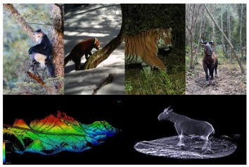 Animal 3D Ecology: Ecosystem Structure Reconstruction & Application-1
 Animal 3D Ecology: Ecosystem Structure Reconstruction & Application