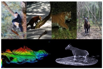
Knowledges about processing of interactions within organisms, between organisms and environment form bedrock of understanding how ecosystem organized. Interactions in forest ecosystem are inferred from patterns of spatial-temporal co-occurrence or avoidance in physical space. Based on the complexity of three-dimensional (3D) ecosystem, ecologists urgently need accurate in-situ data to construct nonlinear relationships and describe complex […]
Dr. Yumei Li was awarded the first-class funding of the 65th batch of the China Post-doctoral Science Fund
On April 26, 2019, the China Postdoctoral Science Foundation announced the list of obtainer of China’s Post-doctoral Science Fund of the 65th batch. Yumei Li, a post-doctor of the digital ecology group, was awarded first-class funding. This fully affirms her excellent scientific research ability and good innovation ability.
Dr. Maggi Kelly visited and gave a lecture on spatial data science
Dr. Maggi Kelly from University of California Berkeley (UC Berkeley) visited our group from March 30th to April 13th for discussing potential collaborations between UC Berkeley and Institute of Botany, Chinese Academy of Sciences. Dr. Kelly is currently a professor and cooperative extension specialist in the Environmental Science, Policy and Management department of UC Berkeley, […]
“Forest3D”: a python package for processing forest lidar data-1
Forest3D is a Python package for processing forest lidar data. It was developed by the digital ecosystem lab from institute of botany, Chinese academy of science. The purpose of Forest3D is providing a simple tool to deal with lidar data from different scanning platforms, e.g. airborne lidar scanners, terrestrial laser scanners and backpack lidar scanners. […]
The “New Generation China Vegetation Mapping” Seminar of Provincial Mapping was successfully held
From January 9th to 10th, 2019, the “New Generation China Vegetation Mapping” provincial mapping workshop was successfully held at the Institute of Botany, Chinese Academy of Sciences. This seminar is based on the “Biodiversity and Ecological Security” project of the “Global Data Science Project” of the Strategic Pilot Science and Technology Project (Class A) of […]
The 4th Workshop on LiDAR Application in Forest Ecology was successfully held!
From June 20th to 24th, 2018, The 4rd workshop on LiDAR Application in Forest Ecology, organized by the Digital Ecology Research Group, was held at the Institute of Botany, Chinese Academy of Sciences. Nearly 300 students from more than 80 universities and research institutes, including the Chinese Academy of Sciences, Peking University, Wuhan University, Fudan […]
The First UAV Industrial Innovation and Application Congress (2018) was successfully held at the Institute of Botany
On October 11-12, 2018, the First UAV Industrial Innovation and Application Congress (2018), sponsored by the UAV Application and Control Research Center of the Chinese Academy of Sciences and organized by the Digital Ecosystem Group of the State Key Laboratory of Vegetation and Environmental Change, Institute of Botany, Chinese Academy of Sciences, was successfully held […]
Welcome! Prof. Roger Bales and Prof. Martha Conklin came for academic communication
Prof. Roger Bales and Prof. Martha Conklin were invited to give lectures on September 10, 2018, at Institute of Botany, Chinese Academy of Sciences. Prof. Roger Bales gave a talk about “Making up for lost snow: lessons from a warming Sierra Nevada”, focusing on five aspects: mountain climate, water balance, snow monitoring, California drought conditions […]
Student of Digital Ecosystem Group Won the First Prize of the Postgraduate Academic Forum
Jin shichao, a PhD candidate of the digital ecology group, won the first prize and the best popularity prize of the 2018 Postgraduate Academic Forum of institute of botany, Chinese academy of sciences. His speech them is “A Deep Learning Pipeline for High-Throughput Maize Phenotyping from Lidar Data”, which introduced three main advancements in the […]
研究组成员赴西班牙参加IGRASS 2018研讨会
2018国际地球科学与遥感研讨会于7月22-27日在西班牙瓦伦西亚举办,本次会议主题着重于“观察,理解和预测我们星球动态变化”,2000多名来自世界各地的科研工作者参加了会议,分享最前沿的科研进展。数字生态研究组苏艳军副研究员和李玉美、马勤博士参加了本次大会。 苏艳军副研究员做了题为“无人机及背包激光雷达系统在林业调查中的应用”的特邀报告,展示了研究组在激光雷达硬件集成、算法研发、软件开发等领域的工作成果,马勤博士做了题为“利用多时相激光雷达数据进行单木层级的林火灾害评估”的报告,李玉美博士以墙报形式展示了研究组的最新研究成果,与国际学者进行了广泛的交流。 三位成员展示了研究组在生态遥感领域研究中所作的贡献,提高了学术成果的影响力,同时,也使研究组更清楚地了解了最新的国际发展,进一步完善研究方向。 苏艳军副研究员在研讨会上作特邀报告 李玉美博士为参会人员介绍研究组成果 马勤博士在研讨会上作报告